Day 1
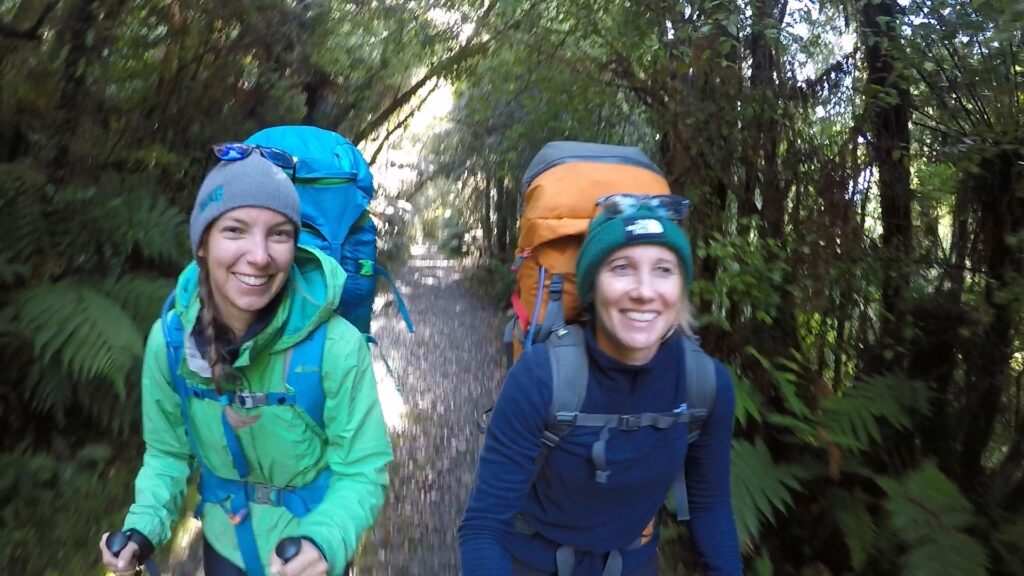
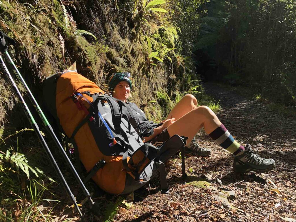
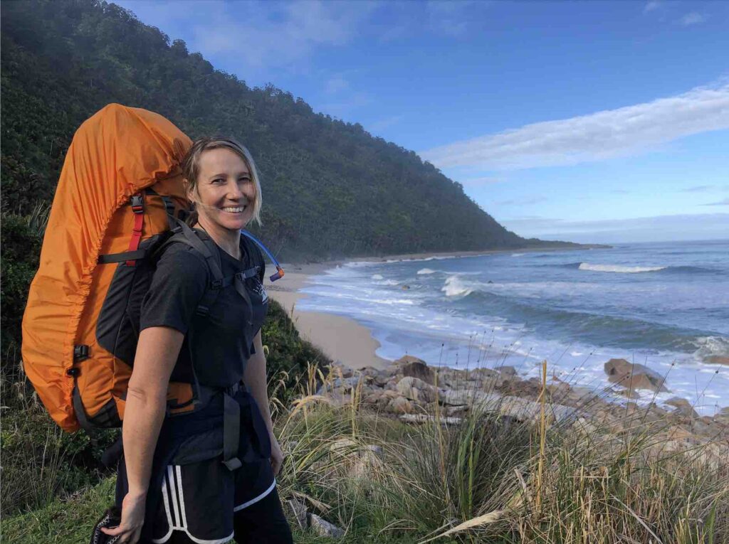
We started the Heaphy Track on a brisk morning at the end of April at the Brown Hut end of the track. We parked our car in the parking lot, managed to get our packs on our backs (with some difficulty), and started walking with high spirits. We had begun a 4 day journey like none we had experienced before.
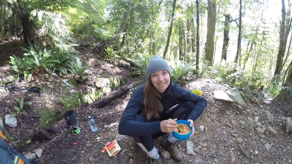
The first day was a 5 hr hike that was a continuous gradual uphill through native forest. The first two hours were great, lots of laughter, a couple of snack breaks, and one break to fill up Amber’s water bottle in the stream. We stopped for lunch about 2.5 hours in, at our halfway point. We fired up our cooker and heated up some Uncle Ben’s rice for each of us, and boiled water for a coffee.
After a lovely lunch break, it was time to continue uphill. At about the 3 hour mark, we found that we started to get annoyed with the track. We were noticing more than ever that we never got a break from up up and up, and the track was quite rocky which required lots of stabilisation. We were using muscles that we were not used to using for SURE.
As we climbed, it got chillier and chillier. We had started off the day shedding layers as we warmed up, but as the altitude increased we found ourselves slowly putting them back on. At this point, we were really feeling it in our shoulders and our hips, and we were ready to get to the hut. Unfortunately, we still had 1.5 hours to go.
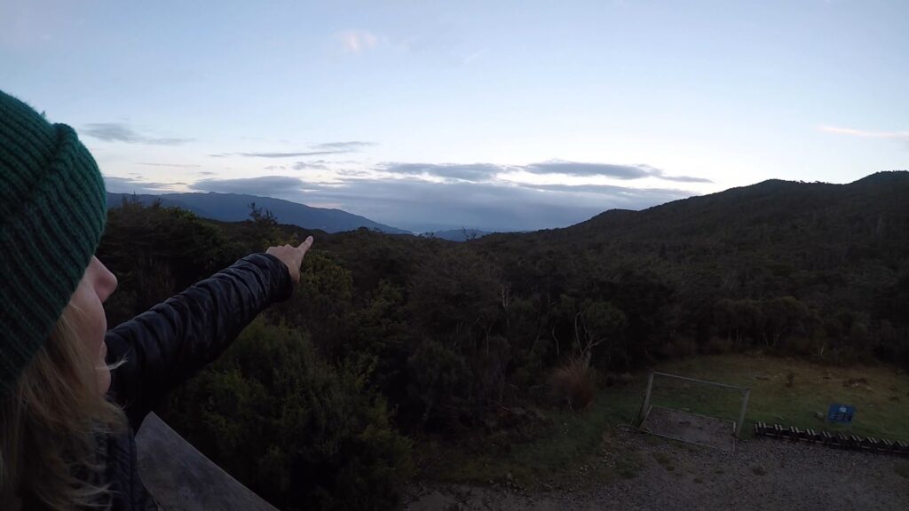
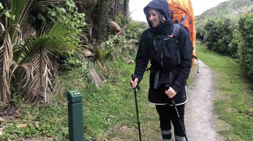
Those last couple hours were the hardest. We finally reached the highest point in the track (thank goodness!) and the last half hour was slightly downhill. The relief from the uphill was barely noticed though, because at that point we were cold, it was starting to rain, and boy were we in pain. We saw ahead of us a post beside the track. Little did we know that that post would be a major symbol in our journey along the Heaphy. It marked one kilometre until the hut.
Seeing this marker was a huge boost in morale. We got excited, and with renewed vigour continued on our journey. What we did not realise, was that it gave us false hope that the hut was super close. That last 20 minutes of the track was the longest yet. We found that our brains tricked us into thinking that the hut would be around the next corner, and then we rounded that corner and no hut, so it must be the next corner, and so on. What seemed like an hour later, Amber spotted it, the Perry Saddle Hut. Both overjoyed and exhausted, we powered through the freezing rain to the hut, which was already full of people and the fire lit.
We were surprised to see that not only did the hut have gas burners to cook on, but also flush toilets and solar lights in the ceiling. We immediately got to boiling water for our dinners, very excited to have a hot meal after an arduous day. We got to chatting with some of the people at our table, learning that they were doing the exact journey that we were, staying at the same huts as us along the way.
After dinner we were feeling broken and destroyed, so we went straight to our bunks for a glass of wine and to read our books. This was around 5:30 and the sun had only just set. By 6:30, we were ready for bed, and by 7 we had our lights out and books away. We couldn’t believe how shattered we were, and felt a bit worried for the days ahead.
Day 2
We woke up the next morning with notable aches and pains in our shoulders and hips. We were stiff walking around the hut to make breakfast, but were in much better spirits than the night before. The sun was shining and it was looking like we had a beautiful day ahead of us. The night before, the warden told us that although we would be hiking for 6.5 hours, the track would be easier than on day 1. I am not sure in hindsight that I completely agree with her on this one.
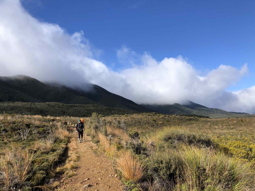
We started out on a beautifulllll gradual downhill, which was a HUGE relief from the day before. The first few hours of the track were fun and silly. We left about the same time as the other groups, so we would pass them when they took a break, and they would pass us when we took a break, and so on. It made the walk a bit more fun, as we had little jokes with them as we would pass each other, and it broke up the monotony a bit. The forest opened up into tussock grassland areas, which looked beautiful in the sunlight. We were up on a hill and could see where the track meandered around, and then we realised we could see the first hut we would pass!
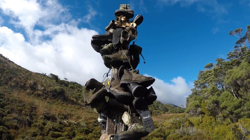
It was over a kilometre away, and on our way there we came across Boot Pole Corner. There was a large post in a bend in the track where hikers have been hanging their old hiking boots for decades. My first thought on seeing the post was that my pack was heavy enough as it was, and no way would I want to have also brought along old hiking boots just to add to Boot Pole Corner! But it did look cool, so I will give it that.
After 2 hours of hiking, we made it to the Gouland Downs Hut, where we ate our morning snack and made friends with some annoying wekas. After our snack we carried on our merry way, to one of the highlights of our journey.
Right after the hut is an “Enchanted Forest” straight out of Lord of the Rings that is speckled with limestone caves to explore. The paths aren’t marked with more than a pile of rocks, and you can leave your pack on the main path while you go exploring. The caves loop under the track back and forth, and you can keep exploring for quite some ways. We went through 3 of the caves, but a couple of guys who were doing the track at the same time as us said that they kept exploring and found heaps and the caves just kept going. It was a super cool little side adventure, and we were so glad that we took the time to explore.
Once we exited the forest, it was back into tussock country. For about an hour, we went up and down, crossed streams (over bridges, none of that straight through the river in winter nonsense), and wound our way towards the Saxon Hut. Before we got there, Amber got an unfortunate bout of low blood sugar, and we decided that we wouldn’t make it to the hut for lunch time. We found a suitable spot on the track as quick as we could, and cooked up our rice and coffee on a bed of soaking moss.
After a lunch of pure carbs, we felt much happier and ready to face the rest of the track. Up we hopped and off we went. To our dismay, 100m down the track was a bench with a view. A bench that would have been the perfect lunch destination. Fortunately, our bellies were full and we didn’t dwell on it. Half an hour after our lunch break we made it to the Saxon Hut, where all of our new track buddies were part way through their own lunch breaks. We stopped to say hi and have a break and a snack. At this point, we were really starting to feel the pain and tiredness creep up, and welcomed a break.
Unfortunately for us, we still had another 3 hours of hiking to go, and due to all the exploring and lunching, it was already 1:30pm. The first hour was alright, but the last 2 hours of the day passed in a blur of pain and exhaustion. My knee started to hurt, and my feet were killing me. Amber’s shoulders and hips were killing her. The scenery was beautiful but we couldn’t appreciate it because it was literally all we could do to put one foot in front of the other. At last, we came to the 1km sign post. Ever the blessing and a curse, the last 20 minutes of the day were agonisingly long in the face of false hope.
We finally made it to the James MacKay Hut around 5:20 (just before dark) after the longest day ever. We set up our bunks, and rushed to sit down and enjoy dinner. Everything was hurting and stiff. We had some laughs over dinner with the people at our table, a mom and her two teenagers who had come from the Gouland Downs Hut. They had arrived to the hut at lunchtime, so they were much more energetic and much less sore than we were. This time we managed to remain upright much longer than the night before. We stayed up until a whopping 8pm, being the party animals we are.
Day 3
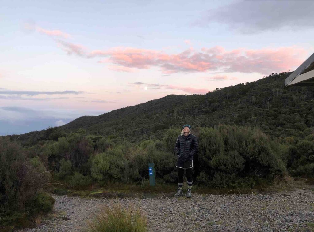
The third day dawned, and having gone to bed so early meant that we woke up to a beautiful sunrise. From the hut, we could see the ocean in the distance and the river mouth where our next destination lay. Also on the horizon was a large and beautiful full pink moon. Of course we got pictures, but of course the moon looks much smaller than it did in real life.
At breakfast, we decided we would try to learn from the past couple of days, and double up on food to fuel our day. In addition to my rice krispies, I had a lentil soup, and Amber doubled her usual breakfast in an attempt to pile on the calories and the energy.
Right when we were about to set off, we heard the wildly loud sounds of a chopper landing nearby. It was cool to see the boxes of kindling being unloaded as we started our hike for the day.
Fortunately, this was a day of downhill. Actual downhill, not like the second day where we thought it was downhill but actually it was little ups and downs and all over towns. We wound our way down through the forest, stopping for little snacks here and there, and to film blue mushrooms and gorgeous moss-covered trees.
This was the day where we found our bodies seemed to actually accept what we were doing. We found that our pace was faster, and we were in less pain in general. That being said, we were definitely still both tired and in pain when we arrived at our lunch destination 3 hours in, Lewis Hut. Lewis Hut was a fantastic location, right on the Heaphy river. We found out that the Lewis Hut is actually set to be demolished and rebuilt, and the night before was the last night that people could stay in it.
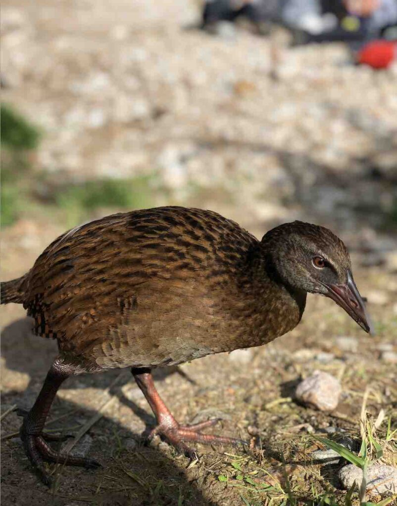
We found a patch of grass in the sun and cooked up our rice. Now that we had made it to ground level, we found that the weka activity increased rapidly. The whole way through lunch I had one of my hiking poles on hand to wave at the wekas who were inching their way closer and closer. At one point we let our guard down and a weka stole our scrubbing brush. Amber leaped to the rescue and bribed it with a hazelnut to get our scrubber back. When I say bribed, I mean she chucked hazelnuts at it until it freaked out and dropped the scrubber.
We then had a lovely surprise, the sign for the next leg of our journey said that the Heaphy Hut was only 2 hours away, not 3 as we expected. Off we went, feeling energised and rested (comparatively).
The last two hours were practically flat and wound through the forest along the river. We saw giant old trees as well as increasing Nikaus. Once again, the last hour was the hardest, with my pain in my feet, and Amber with pain in her ankle and shoulders.
We made it to the Heaphy Hut just after 3pm, with plenty of time before dark. This time, the hut was full so we set up our tent. Putting our tent up, we couldn’t be happier. The hut life is great, and we met so many interesting people and we were warm and content, but we were very much ready for some time to ourselves. After setting up our tent, we made dinner. At 4pm, we ate. Yes, at a super normal dinner time.
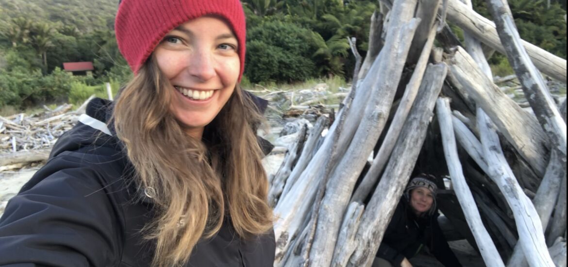
After dinner, we decided to go for a walk along the beach. The Heaphy Hut is situated right on the mouth of the Heaphy River, where it meets the Tasman Sea. The sun was starting to set, and we had the most romantic walk into the sunset with a horde of sandflies accompanying us. Super tip: bring bug spray no matter how cold you think it may be.
After our walk we hopped into our tent to warm up, and had some lovely quiet reading time together. A perfect way to end the day.
Day 4
On the last day we hopped up at our usual 7am, very happy not to have the hustle and bustle of other trampers around us as we popped out of our tent to boil water for coffee. As I put the pot on to boil, I saw that one of the groups was already setting off. This made us slightly nervous, since normally groups set off around 8:30-9am, not 7am, so we thought that maybe we were missing something, like the last day was much longer than we thought it would be. We enjoyed our breakfast, and started to pack up the tent. As we were packing up, groups continued to set off. We remembered that we booked a later time for the shuttle and realised these groups must be needing to catch the earlier one.
We set off, and one kilometre in we said goodbye to the last 1km marker we would see. Those signposts that were a blessing at the start of the day (boy, we’re making good pace, look 1k already!), and a curse at the end of it (oh my god we still have a whole bloody kilometre to go, why can’t we just be there already?). Who would’ve thought that those little green posts would have meant so much on that first day when we saw our first one 20 minutes into our hike?
The last day was pretty much all flat, with little ups and downs here and there. I discovered that the way to less pain for me was to go fast (at my own pace but it was faster than Amber), and then stop and wait every few minutes leaning on my poles to take the weight off my aching feet. Amber discovered that the way to less pain was to go slow (her own pace, not trying to rush to keep up with me), and let me go ahead. The previous days we took turns setting the pace all day, and we realised that it wasn’t working for either of us. This way we were both happier and in less pain.
The views on day 4 were the best views of the whole journey. It alternated between stunning coastal white sand beaches contrasting with epic cliffs and forests, to into the forest of Nikau palm trees everywhere.
We stopped for lunch 2.5 hours in at Mid Point. This time, a weka managed to steal our chocolate, which was a big ol’ no no. Amber to the rescue, she managed to get it back without bribery this time, just mad skills.
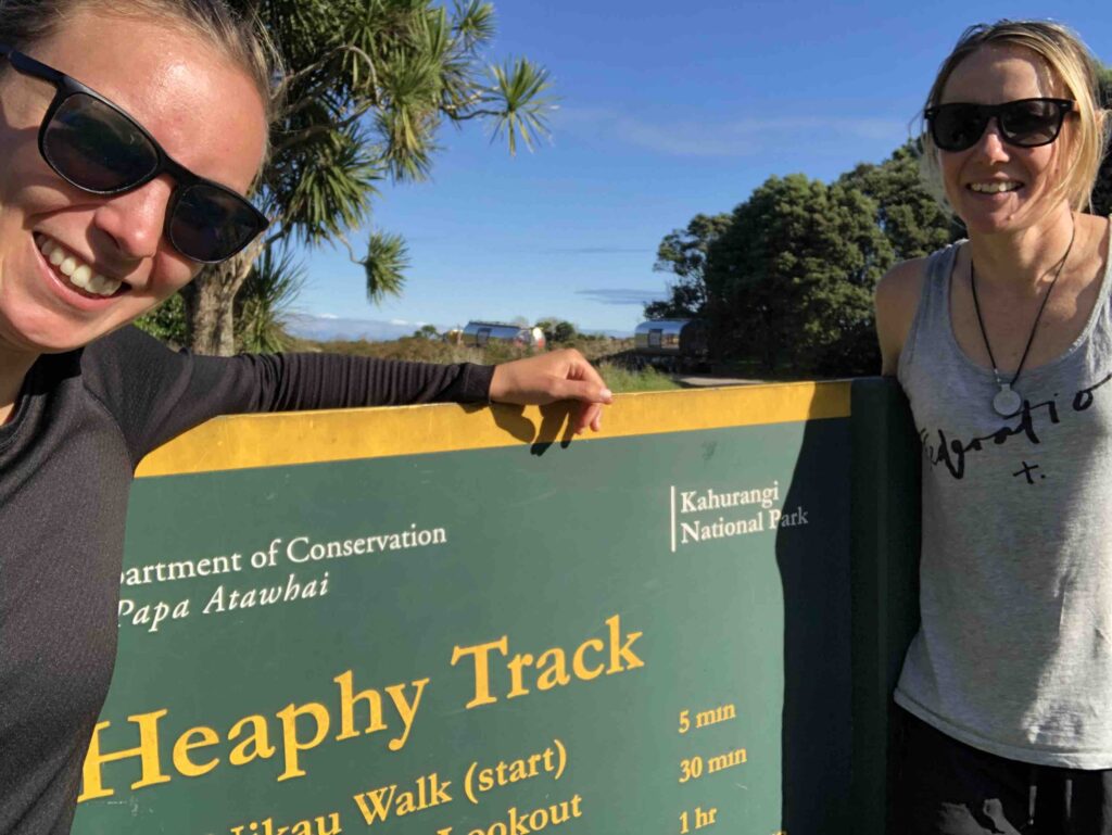
After lunch we carried on our merry way, Amber’s ankle started to hurt more and more and my feet started to ache again. We didn’t take many breaks though, because we could feel how close we were to the finish line. The last stretch of the track was 100m uphill, and then back down again. We powered through, barely speaking, just wanting to get to the end. When we finally came around the final bend that opened to the parking lot, we felt overjoyed. We plopped ourselves down on the first picnic table we saw, and cooked ourselves up a mid-afternoon soup. We had an hour before our shuttle picked us up, and we took the time to rest, recover, refuel and take pictures with the Heaphy Track signs.
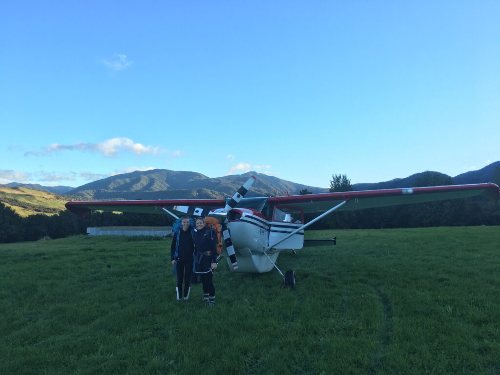
Our shuttle came to take us to the airport. We loaded up and off we went away from the forest. Fifteen minutes later, we made it to the smallest airport we had ever been to. We called the pilot of the plane picking us up, and soon discovered that he had accidentally booked us for 29 May, not the 29 Apr. Fortunately, he was a cool dude and came to pick us up anyways, only arriving 5 minutes later than our original time. He flew in on a tiny little plane, and watching him land we started to get excited. The plane was a 4-seater, including the pilot. Amber sat up front next to the pilot and I sat in the back. We had to wear headphones with a microphone to communicate with each other. Then began the coolest experience of my life.
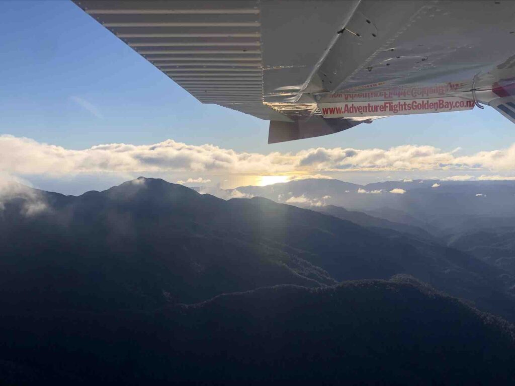
We took off just after 4, so the sun was starting to set, giving everything a stunning golden glow. Our pilot, Mit, was relaxed and funny, and an excellent tour guide. We flew directly back over the track, with Mit pointing out caves, the huts we stayed in, and the track below us. It was the perfect way to end the trip, seeing the distance and mountains we had just painstakingly walked for 4 days, over a 20 minute long flight. The whole time we were in the plane, I was grinning from ear to ear, what a way to end a journey.
We landed near Brown’s Hut, and Mit drove us back to the start of the track where our car was parked. We felt as though it had been an eternity since we had been here last. The Heaphy Track was unforgettable, with its ups and downs, highs and lows, beautiful scenery, and awesome people, it truly was a great walk.